Since the dawn of the internet, networks have created maps to visualize their reach, capabilities, capacities, operations, and more. Countless such maps have been produced. A session at the upcoming TNC – the annual flagship event of the European R&E network association GÉANT – is dedicated to a new tool which will help map not just one network, but the entire Global Research and Education Network (GREN).
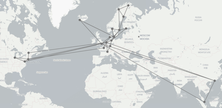
The idea put forward by the GREN Mapping working group is to provide a tool that allows each of the regional and national R&E networks across the globe to offer data for maps – locations of nodes and links, and their properties – in a standardized data format, supported by open-source software, and to allow all this data to be aggregated to create a map dataset of the GREN.
“The GREN is constantly evolving, so if someone would, hypothetically, create an instantaneous map of the network, it would probably be outdated even before it was published. Instead, the real innovation is a data format which will allow any R&E network to merge an updated representation of its own infrastructure with the infrastructures of the other networks,” explains Lars Fischer, Strategy & Policy Officer at NORDUnet.
“Not only will the GREN Map provide a visualization of the GREN topology, it will also be a valuable tool for creating local maps of regions, adding maps to network operations tools, and much more” he adds.
The GREN Map was initiated by the Global Network Advancement Group (GNA-G).
TNC 21 is held as an online event June 21-25. During the demo session at TNC 21, a prototype of the GREN Map will be shown. The prototype has been coordinated by Canadian NREN CANARIE and GÉANT. NORDUnet has contributed to throughout the development and has provided data on its current infrastructure for the GREN Map demonstration.


